In our last post we described a recent trip we took up to the top of Mt. Ka'ala, the highest mountain on the island of Oahu, topping out at just over 4000 feet. We described how the temperature changes with the altitude, decreasing the higher you get. We discussed the rate at which this happens, which is described as the
adiabatic lapse rate. We also discussed
humidity and how atmospheric moisture content affects this cooling rate. All of this helped us understand the basic pattern of rainfall on the Hawaiian islands. In this post one of the geography crew will describe how climate, which is determined by temperature and moisture, changes with altitude here in Hawai'i. He'll also tell us about how these different zones are associated with vegetation.
Climate Zones
Have you ever wondered why clouds
 |
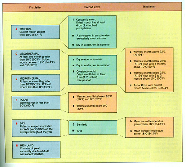
| Koppen chart from here. |
form high on the mountain slopes and not at the mountain base, or why there is a dramatic change in plant species as you move upslope? A lot of this has to do with the distinct
climate characteristics found in the islands. Four of the five major climate zones described in the
Köppen climate classification system can be found in the Hawaiian Islands and within these zones there exists a host of distinct microclimatic sub-zones determined by
temperature and
precipitation characteristics. The differences in microclimates and the associated vegetation that can be found within these microclimates can be attributed to the vertical profile of the atmosphere. As you increase in elevation you decrease in temperature at a specific lapse rate depending on your environment and this temperature profile dictates the phase change of water in the atmosphere.
Climatic
zones on mountain slopes in Hawai‘i can
be characterized with reference to 4 atmospheric layers described by Riehl et
al., (1951). These 4 climate zones with
the corresponding atmospheric layers in parentheses are: 1) marine (subcloud),
2) fog (cloud), 3) transitional
(inversion), and 4) arid (free
atmosphere). The sub cloud layer extends from sea level to the lifting condensation
level ( LCL, 600 - 800 m) at which point clouds begin to develop. In a simpler explanation the LCL is the
point at which a warm moist air mass needs to be lifted so it sufficiently
cools to the point at which water makes the phase change from a gas to a liquid
(condensation). The cloud layer exists from the LCL to the base of the Trade Wind
Inversion (TWI) which can lie anywhere between 1000 and 4000 m (Cao et al.,
2007). The TWI is a synoptic subsidence
of warm air that was originally uplifted at the equator by convective and
convergent processes. The TWI, which is
present 80-90% of the year (Cao et al., 2007), has a profound impact on the
climate at high elevations The thickness
of the inversion layer is about ~300
m and above this point the stable dry air of the free atmosphere layer can be found.
The height and thickness of each of these atmospheric layers vary in
space and time in response to large-scale circulation features and surface
heating (Giambelluca and Nullet, 1991).
This layered system exists only in the presence of the trade winds and
disappears when cyclonic systems interrupt them.
The
vegetation characteristics across elevation gradients in Hawai‘i are dependent
on several factors, including, substrate, topography, precipitation, available
genotypes and the fragmentation and severe modification of native vegetation,
especially at lower elevations (Mederios, 1986). On hike up the mountain we were able to
experience lower two climate zones mentioned above and the distinct vegetation associated with
these zones. Three basic ecosystem types occur between the leeward coast and the summit of Mt. Ka‘ala. These can be distinguished by rainfall, elevation, and vegetation type. Lowland dry shrubland and grassland occurs at the lowest elevations although introduced trees are also present. Lowland dry and mesic forest, woodland and shrubland occurs further inland. At higher elevations wet forest and woodland can be found. A special type of ecosystem called tropical montane cloud forest (TMCF) occurs in the summit region and harbors many rare natives species. The ecosystems at lower elevations are dominated by introduced vegetation as a result of disturbance. Native vegetation becomes more dominant the farther one moves up the mountain. The vegetation at lower elevations in the Waianae range area of Mt Kaala is dominated by introduced tree species. Near the coast kiawe (Prosopis pallida) is frequent. Moving inland, koa haole (Leuceana leucocephala) becomes a dominant species. Along the first part of the trail to Mt Kaala itself both species can be seen. Larger silk oak trees (Grevillia robusta) can also be seen. Coffee trees (Cofea Arabica) can also be seen. Moving up the steep slope rainfall increases and disturbance decreases. Native tree species like koa (Acacia koa) and ohia (Metrosideros polymorpha) become common. The last leg of the trail moves into the cloud zone and ohia becomes the dominant tree. Olapa or lapalapa Cheirodendendron trigynum or platyphyllum) becomes more frequent. Olomea (perrotetia sanwicense) is also present. These are the dominant trees in the mosaic and bog at the summit. Also very frequent shrubs include pukiawe (Leptocophylla tameiameia). Rare plants like kolii (tremotlobelia macrostachyus are also present.
References
Cao, G. G., T. W. Giambelluca, D. E. Stevens, and T. A. Schroeder (2007), Inversion Variability in the Hawaiian Trade Wind Regime. J. Climate, 20, 1145–1160, doi: 10.1175/JCLI4033.1
Giambelluca, T.W. and Nullet, D. (1991) Influence of the trade-wind inversion on the climate of a leewared mountain slope in Hawai‘i , Clim Res., 1, 207-216

No comments:
Post a Comment